Location Intelligence
A powerful and instant tool to understand the company and social phenomena
Location Intelligence solutions enable the representation and geographic navigation of company data through a Dashboard that has advanced features for geographic data analysis.
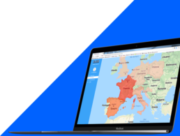
The data represented on geographic maps are a powerful and immediate way to better understand company data and compare them with market, socio-economic, competitor-related data by visualizing and navigating them on interactive maps.
The geographic data analysis and aggregation functions, implemented through Roll-Up and Drill-Down operations on maps, enable you to access otherwise incomprehensible information.
Who is it for?
Production and service companies of all production sectors
Location Intelligence solutions grant Managers, Commercial Managers, IT Managers and Logistics Managers of the Ceramics, Mechanical, Logistics, Biomedical and Pharmaceutical sectors, as well as Consulting, Facility Management and Global Services, the following competitive advantages :
• Understanding sales performance and develop advanced business strategies
• Implementing an advanced monitoring of production, logistics and sales processes through new KPIs
• Promptly monitoring the business processes and services provided to customers
• Optimizing strategic decisions, control activities of production processes and logistics in the various sites
PUBLIC ADMINISTRATIONS AND INSTITUTIONS ON A LOCAL, NATIONAL AND INTERNATIONAL LEVEL
The solutions for Location Intelligence grant Senior Administrative Officials and Managers of Public Administrations, such as Regions, Provinces, Municipalities, National and Local Agencies, Consortiums, the following advantages:
• Understanding social, environmental, health phenomena together with labor market and public finance related ones
• Optimizing strategic decisions and control activities
• Making future predictions on the basis of comparisons with Open Market, environmental, health and socio-economic data
Geographic maps
Understanding your company
Data represented on the geographic maps are a powerful and immediate way to understand the company, the sales and logistics processes and to better appreciate social, economic, health and environmental phenomena.
Data comparison
Interactive maps
Comparing company data with socio-economic data and market and competitor-related data, through the visualization and navigation of interactive maps, enables a better understanding and prompt monitoring of business processes as well as an optimization of strategic decisions.
Geographical analisys and visualization
Roll-Up and Drill-Down
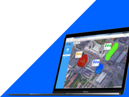
The geographic data analysis and aggregation functions, updated in real-time, enable you to access information otherwise not comprehensible, while navigating the data on the maps and aggregating them according to geographical areas through Roll-Up and Drill-Down operations.
RELATED CASES
Case studies
RELATED TOOLS
MOMIS DASHBOARD
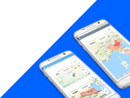
Web and Mobile application for geographic data analysis and aggregation that enables you to browse data on maps and aggregate them according to geographical areas through Roll-Up and Drill-Down operations


